Utilizing Sentinel-1 satellite data and commercial satellite data (e.g., ICEYE, TerraSAR-X, COSMO-SkyMed, ALOS series), we provide millimeter-level precision InSAR data analysis and processing services across multiple industries.
- Fuzhou Hengyu International A509
Monitoring Critical Assets with InSAR
We deliver millimeter-level precision InSAR monitoring for ground subsidence, bridges, dams, highways, and other critical infrastructure.
Service Areas


Geological Hazards

Bridges

Highways

Mining

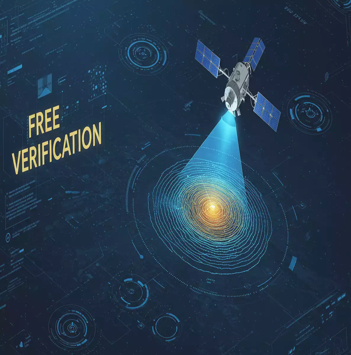

Free Validation - Experience Millimeter-Level Precision!
To demonstrate InSAR's transformative potential, we offer complimentary data comparison services showcasing DeepInSAR's unparalleled precision.
Case Studies
Compared to traditional monitoring equipment, InSAR requires no field surveys, device installation, or regular maintenance. Leveraging satellite radar signals, it monitors deformation trends globally—including hazardous or inaccessible areas—with adjustable intervals from hours to days.
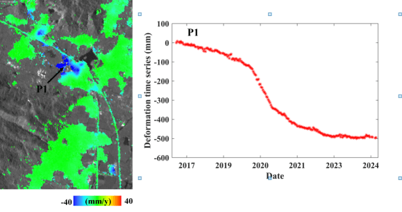
Ground Subsidence Monitoring
Left: Regional subsidence rate map | Right: Time-series deformation at Point P1
As a slow-onset geological hazard, ground subsidence has become a global environmental concern. While traditional methods like leveling and GPS offer high accuracy, they suffer from high costs, low efficiency, and limited spatial coverage. InSAR delivers millimeter-level deformation data with continuous spatial coverage, accurately revealing spatiotemporal evolution characteristics of subsidence.
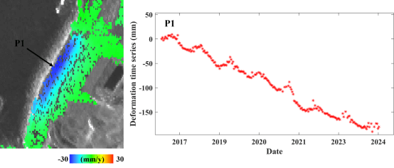
Dam Deformation Monitoring
Left: Dam deformation rate map | Right: Time-series deformation at Point P1
Dam safety monitoring is crucial for water resource infrastructure. InSAR overcomes limitations of traditional methods by providing high-precision, large-scale, non-contact measurements. It captures long-term deformation dynamics, monitors operational performance, and assesses structural degradation caused by earthquakes or floods.
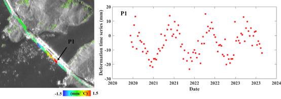
Bridge Deformation Monitoring
Left: Bridge thermal expansion coefficient map | Right: Time-series deformation at Point P1
InSAR revolutionizes bridge monitoring by delivering millimeter-level accuracy over kilometer-scale coverage. The technology enables whole-structure monitoring without installing reflectors, providing safe, long-term deformation data for assessing structural responses to thermal changes and dynamic loads.
Mining Subsidence Monitoring
InSAR has become vital for mining deformation monitoring. By analyzing multi-temporal SAR phase differences, it detects millimeter-scale surface movements, supporting mine safety management, hazard early warning, and environmental impact assessments.
Note: Data anonymization applied to protect client confidentiality. InSAR also applies to pipelines, railways, transmission towers, and other critical infrastructure monitoring.
Service Process
01 - Consultation & Validation
After initial requirements confirmation, we conduct free preliminary validation using Sentinel-1 data at no cost.
02 - Confirmation & Engagement
Upon satisfactory validation, we formalize requirements through contracts with defined payment terms and mutual obligations.
03 - Execution & Reporting
We conduct periodic monitoring and provide progress updates until service completion, followed by comprehensive data handover.
Let's Collaborate
Unmatched precision, comprehensive services, and cost-effectiveness combine to deliver superior monitoring solutions!